Navigating Coastal Flooding in Downtown Charleston, SC: A Detailed Overview of Vulnerable Streets and Mitigation Efforts
As a realtor in Charleston, South Carolina, a city renowned for its rich history, vibrant culture, and picturesque waterfronts, is also grappling with the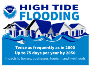 persistent challenge of coastal flooding. Located on the Atlantic coast, Charleston SC faces the dual threat of heavy rains and high tides, which frequently inundate its low-lying areas, especially downtown. In this article, we aim to provide a detailed examination of the specific streets and roads in downtown Charleston prone to flooding, along with the ongoing efforts to mitigate this recurring issue. It is imperative, that your agent have an understanding of the boroughs & neighborhoods of Downtown Charleston SC, and perform a flood check of any homes you are considering. The house itself may not flood, but the street may get up to 4 ft of water in front of your house or condo building thus rendering you essentially trapped in your home, and potentially a flooded vehicle. The only positive to take from this is that normally the standing water only stays that high during the first few hours of the rain or high tide. Once the rain or tide has subsided the standing water begins to dissipate relatively quickly. Your biggest risk is damage to your parked car in most instances, assuming you do not have off-street parking. Essentially downtown Charleston has a spine that runs down the center of it which is a “hill” for as much as you can call it that. Nonetheless, as you go further away from the “spine” the lower the ground gets out toward the water. So the more the real estate can be closer to the inside the better off you will be. That said, some streets are just low, and thus water holds there.
Understanding Coastal Flooding in Downtown Charleston:
Coastal flooding in downtown Charleston is primarily driven by a combination of factors, including sea level rise, storm surges, and heavy rainfall events. The city’s unique topography, characterized by its low elevation and proximity to water bodies like the Ashley and Cooper Rivers, exacerbates the vulnerability to flooding, particularly during high tides and severe weather events. Other factors that are very important to consider before purchasing a home are the cost AND availability of flood insurance. This is where Charleston SC FEMA flood maps will come in handy. Your preferred insurance provider will have their insurance risk portals but you may be wise to check into the addresses of the homes before calling them.
Prominent Streets of Downtown Charleston SC and Roads Affected by Flooding:
1. East Bay Street: One of the most iconic thoroughfares in downtown Charleston, East Bay Street experiences frequent flooding, especially at its intersections with Market Street and Vendue Range. The historic district along East Bay, renowned for its cobblestone streets and colonial-era architecture, often contends with water accumulation during heavy rains and high tides.
2. Battery Street: Situated along Charleston’s historic Battery promenade, Battery Street is susceptible to flooding, particularly during king tides and tropical storms. The scenic waterfront area, which offers panoramic views of Charleston Harbor, faces challenges from storm surges and rising sea levels, resulting in periodic inundation.
3. Concord Street: Running parallel to the Ashley River, Concord Street encounters flooding, particularly near the South Carolina. Aquarium and the Charleston City Marina. This would affect luxury condo buildings like Dockside, Lauren’s Place & Vendue Range. The proximity to the waterway makes Concord Street susceptible to tidal fluctuations and storm-related inundation, impacting vehicular and pedestrian traffic in the area. Concord at Charlotte St is often closed.
4. Market Street Area: A famous bustling thoroughfare lined with shops, restaurants, and historic landmarks, Market Street experiences regular flooding at various intersections, notably near the City Market and Meeting Street.
- S Market St between Meeting St and E Bay St
- N Market St between Bay St and Meeting St
- King Street – Market Street –> Beaufain Street
- Washington Street – North Market Street –> Laurens Street
5. “South” Harleston Village – Virtually all of this community, but particularly Barre St between Calhoun & Broad, Neighborhoods like Halsey Park and Halsey Blvd. Basically the closer to the river the worse it gets.
6. Morrison Drive (Romney Street —> Huger Street)
7. Washington Street (Calhoun Street to Laurens Street)
8. Savage Street – AND much of Rutledge In the last few years more and more homes in this area of South of Broad St have been raising their homes to account for flooding. This once would have been not allowed given the city’s strict rules about preserving the history of downtown Charleston architecture. However, given the severity and frequency at which this is happening the city ARB has no choice but to relent.
- Rutledge Ave between Calhoun St and Bennett St
- Rutledge Avenue at Bull Street
- Rutledge Avenue between Calhoun Street and Bennett Street
9. Corner of Smith & Morris
10. Intersection of President and Line –
11. Vanderhorst & Ogier and Calhoun Street at Ogier Street
12. Tradd St (one of the most recognized in S. of Broad) at Ashley Ave, Rutledge, Tradd at Council St.
13. If you’re considering buying a home near MUSC or the VA Hospital: The streets, corners, and blocks that floods often, and have regular road closures.
-
- Ashley Ave between Calhoun St and Bull St
- Calhoun St between Courtenay St and Bull St
- Gadsen St between Calhoun St and Bull St, Gadsen at Bennett
- Ashley Ave at Daughtry St to Calhoun St
- Beaufain Street between Lockwood Drive and Smith Street and between Rutledge Avenue and Barre Street
- Bull Street between Ashley Avenue and Barre Street
- Church Street between Cumberland Street and Pinckney Street
- Fishburne Street at Lockwood Drive, at President Street, Fishburne
- Hasell Street at Meeting Street, at Washington Street, between King Street and E Bay Street
- Flood Street between Line Street and Allway Street
- Jonathan Lucas Street between Calhoun Street and President Street
Other Common Streets that pond upon high-tide and/or heavy rainfall
- King Street at Line Street
- King Street and Huger Street between Moultrie Street and Columbus Street; between Benson Street and Dingle Street.
- Line Street at President Street and Norman Street
- Line Street at Hagood Avenue
- Meeting Street at Hasell Street and Huger Street
- North Nassau Street and Romney Street between Conroy Street and Isabella Street; Meeting Street and N Hanover Street
- Pinckney Street between Meeting Street and East Bay Street
- Radcliff Street at Thomas Street
- Smith Street at Beaufain Street and between Calhoun Street and Bull Street
- Wentworth Street at Coming Street to Gadsden Street and at Lockwood Drive
ROAD CLOSURES MAP CHARLESTON SC (BLUE is for flooding)
Mitigation Efforts and Adaptation Strategies:
As for downtown peninsula real estate owners are concerned, and potential buyers – In response to the recurrent threat of coastal flooding, the City of Charleston has implemented several mitigation efforts and adaptation strategies to enhance resilience and minimize the impact on downtown communities. These initiatives include:
– Stormwater Management Improvements: The city has invested in upgrading stormwater drainage systems and implementing green infrastructure solutions to mitigate flooding and improve water retention capacity.
– Elevating Critical Infrastructure: Critical infrastructure such as pump stations, roadways, and utilities are being elevated to reduce vulnerability to flooding and ensure continuity of essential services during extreme weather events.
– Public Awareness and Education: The city conducts outreach programs and public awareness campaigns to educate residents and businesses about flood risks, emergency preparedness, and sustainable practices to mitigate the impact of coastal flooding.
– Long-Term Planning and Policy Development: Charleston collaborates with federal, state, and local agencies to develop comprehensive floodplain management plans, zoning regulations, and building codes that prioritize resilience and adaptation to climate change-induced coastal hazards.
Conclusion:
Coastal flooding remains a pressing challenge for downtown Charleston, with specific streets and roads facing recurrent inundation during heavy rains and high tides. However, through proactive mitigation efforts such as the “Bluebelt program”, adaptive grant strategies, and community engagement, the city strives to enhance resilience and ensure the long-term sustainability of its waterfront neighborhoods. As Charleston continues to confront the impacts of climate change, collaborative action, and innovative solutions will be essential in navigating the complexities of coastal flooding and safeguarding the city’s historic charm and cultural heritage. The peninsula of Charleston isn’t the only community of the greater Charleston SC area that struggles with flooding, and for those living in the West Ashley side of town, there is hope in the way of investment with mitigation funding.